
Alor Dive Site Maps and Current Profiles: A 2027 Planning Guide
Alor dive site maps and current profiles chart where the Pantar Strait’s water actually moves — pairing depth bands, entry points and tidal pull with a diver’s logged experience. As of 2026 no single public master map exists; the working version is built site by site with licensed Alor guides, permit in hand.
What do Alor dive site maps and current profiles actually show?
A useful Alor map is not a tourist brochure. It records three things per site: the depth range you will actually dive, the direction and strength of current at different tide states, and the entry-and-regroup plan that keeps a group together. In the Pantar Strait, surface currents run hard enough that guides brief a rapid descent, fast equalising, and a regroup around 5 metres before the reef takes over. Most fun dives sit in the 15-25 metre band. One documented scalloped-hammerhead site drops to roughly 32 metres in very strong current and asks for genuine fitness.
Because Alor and Pantar sit inside a managed marine protected area in the eastern Lesser Sunda Islands — part of the Coral Triangle’s exceptionally rich waters — a site map is also a compliance map. Every diver must attend a mandatory briefing by MPA officers, pay a marine park fee, and hold a permit before entering the water. Guides need special certification to lead inside the Alor MPA on top of their agency cert, and diver numbers per site are capped by WWF-determined carrying capacity. A map that ignores those caps is fiction.
Which Alor zones matter most when reading current?
Alor-Pantar breaks into a few working zones, each with its own current signature. The table below is Currentline’s own planning shorthand as of 2026, drawn from operator briefings and partner site lists — indicative, and always subject to the day’s tide and the MPA briefing. When we assemble a route for a guest planning custom Alor diving expeditions, the licensed partner’s site list and the MPA’s rules set the outer boundary before preference ever enters the picture.
| Zone | Typical depth | Current character | Best suited to |
|---|---|---|---|
| Pantar Strait walls | 15-25 m | Strong, tidal; rapid descent then reef cover | Experienced, wide-angle shooters |
| Kalabahi Bay muck | 5-18 m | Gentle, sheltered volcanic black sand | Macro divers, year-round critters |
| Pasir Merah (north of Pura) | 12-22 m | Moderate on red-sand slopes with gas vents | Intermediate, unusual terrain |
| Hammerhead site | to ~32 m | Very strong; fitness-dependent | Deep-comfortable, high-air-efficiency |
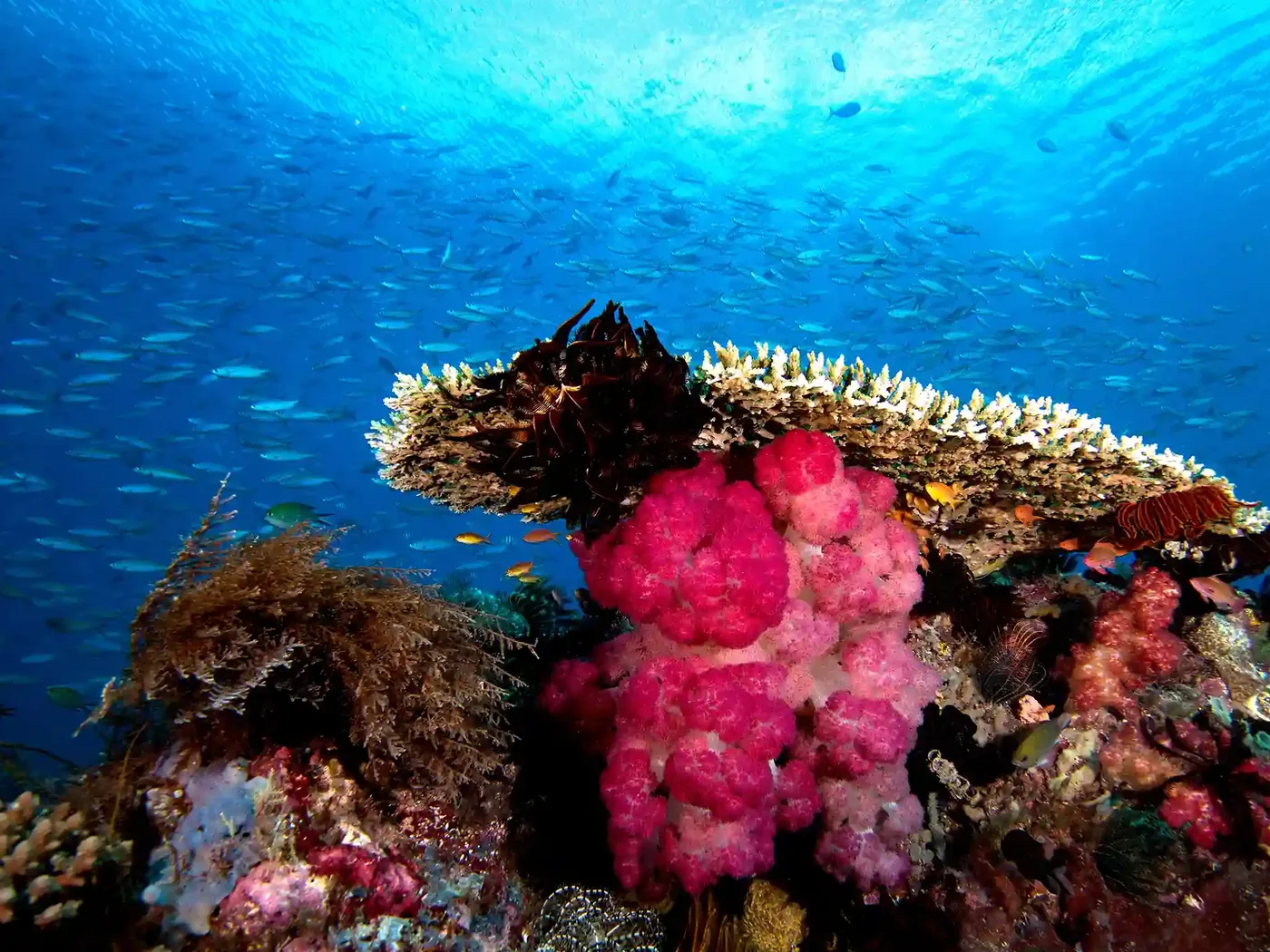
Kalabahi Bay is the shelter valve. Its volcanic black-sand slopes are a muck-diving hotspot for macro shooters chasing Pegasus sea moths, mimic octopus, seahorses, nudibranchs and frogfish — and because those critters barely travel, the bay stays productive year-round even when the strait is ripping. The strait itself favours wide-angle: schooling fish, mola mola, dolphins, pilot whales and the occasional orca. Blue-whale and hammerhead encounters belong on a map as possible, never as a promise.
How do current and depth shift across the season?
Current profiles are seasonal, so a map without a calendar misleads. Conditions are best from April to November, and October-November brings the most prevalent currents — the same window that makes drift dives thrilling also makes them demanding. The rainy season, roughly November to March, unsettles the surface, cuts visibility and adds rain. Here is how the year tends to stack up.
| Window | Water temp | Visibility | Current & notes |
|---|---|---|---|
| Mar-Apr | ~25 C | Building | Transition; thermoclines can drop sites to 20 C or lower |
| May-Sep | 31-32 C surface | Can fall to 15 m or less in plankton blooms | SE monsoon; Sep best for mola mola |
| Jun-Oct (dry) | Warm | Up to ~40 m | Clearest water of the year |
| Oct-Nov | ~25 C | 25-30 m typical | Most prevalent currents; peak drift |
Two planning facts sit under that table. Thermoclines can punch a warm 31-32 C site down to 20 C without warning, so exposure protection is mapped to the site, not the surface reading. And every dive here is no-decompression: partners run a typical 60-minute bottom-time limit or a turn at 50 bar, no solo diving, minimum PADI Open Water, with 50-100 logged dives recommended for comfort in the strait’s pull.
Why does site mapping point toward 2027, not back at 2026?
Alor is still the frontier, and the dated signals from 2026 read as an outlook, not a prediction. Carrying-capacity caps mean the number of divers a site can legally hold does not rise with demand — so as interest in Alor’s “last untouched” reputation climbs toward 2027, the scarce resource is not the reef but the permitted slot on the right tide. Mapping ahead is how you protect a trip that has not been booked yet.
That is the honest case for building profiles now rather than improvising later. A land-based reference resort on Pantar caters to just 16 divers across standard and deluxe bungalows in local traditional style, runs small low-emission boats, and reaches 40-plus dive sites within 30-45 minutes — a spread that only pays off when the day’s current picks the site, not the other way round. Mainstream liveaboards such as a Seven Seas Alor Sea itinerary run seasonal September-October trips, boarding at Kalabahi Bay and diving sites like Pasir Merah’s volcanic red-sand slopes north of Pura Island. Those fixed seasonal windows are exactly why a 2027-ready map front-loads the scarce dates.
How does a map become a real itinerary?
A profile is raw material; sequencing is the craft. A workable Alor plan reads current-first, then layers everything else on top.
- Match the diver to the site, not the reverse. The hammerhead’s ~32 m strong-current site is off the table for anyone short of deep-comfortable and fit.
- Bank a shelter option daily. Kalabahi Bay’s muck lets a group dive productively when the strait is unworkable, and its critters hold year-round.
- Insure before you plan. DAN or equivalent dive-accident insurance is mandatory here because the nearest hyperbaric chamber is in Bali, and evacuation and chamber costs sit outside standard medical cover.
- Respect the rules as fixed points. The permit, marine park fee, MPA briefing and the ban on visitor fishing and spearfishing are constraints, not variables.
Read that way, Alor dive site maps and current profiles stop being a wish list and become a decision tool — the difference between a trip that survives a rough tide and one that gets cancelled at the jetty.
Frequently Asked Questions
Is there a single official master map of every Alor dive site?
No. As of 2026 no public master map or price-listed site catalogue exists. Working profiles are assembled site by site from licensed Alor operators’ own lists and the mandatory MPA briefing, which caps divers per site by WWF-determined carrying capacity. Any map you use should be cross-checked against the permit and briefing on arrival.
How strong are Alor’s currents compared to typical reef diving?
Considerably stronger. Pantar Strait sites often need a rapid descent, quick equalising and a regroup near 5 metres before the reef offers cover. One documented hammerhead site reaches about 32 metres in very strong current. Operators recommend 50-100 logged dives for comfort, and no-decompression, no-solo rules apply throughout.
Which season gives the clearest water for reading a site’s profile?
The dry season, roughly June to October, delivers the best clarity — visibility can reach around 40 metres. October-November brings the most prevalent currents for drift diving, while May-September plankton blooms can drop visibility to 15 metres or less. September is also the strongest month for spotting mola mola in the strait.
More from the journal
Keep reading
Alor vs Komodo Liveaboard Costs: A 2026 Diver’s Breakdown
Alor liveaboards usually cost more per dive than Komodo ones for structural reasons: long crossings, heavy fuel burn and thin…
Alor–Pantar Strait Hyperbaric and Evacuation Logistics: A 2027 Safety Outlook
The nearest recompression chamber to the Alor–Pantar Strait sits in Bali, hundreds of kilometres and a multi-leg journey west, so…
Alor to Komodo Frontier Liveaboard Expeditions: A 2027 Route Outlook
An Alor-to-Komodo frontier liveaboard expedition strings together two of Indonesia's wildest dive regions in one crossing — current-swept Pantar Strait…
Community-Based Marine Conservation Projects in Alor: A 2027 Outlook
Community-based marine conservation in Alor centers on the Alor marine protected area (MPA) around Kalabahi Bay and the Pantar Strait,…
Alor and Forgotten Islands Combination Itineraries: A 2027 Crossing Guide for Photographers
A combination itinerary pairs Alor and Pantar's current-swept walls with the remote Forgotten Islands arc toward Banda — usually a…
Kupang Gateway Guide for Alor Divers: 2027 Group Logistics
Kupang — the East Nusa Tenggara provincial capital on Timor — is the practical mainland gateway for dive groups bound…